As snow accumulated Monday in the Sangre de Cristo Mountains and a flood watch stretched nearly the length of the state's eastern side, the severe conditions that struck Sunday were expected to continue through Wednesday morning.
April showers bring May flowers? Forget the saying this year.
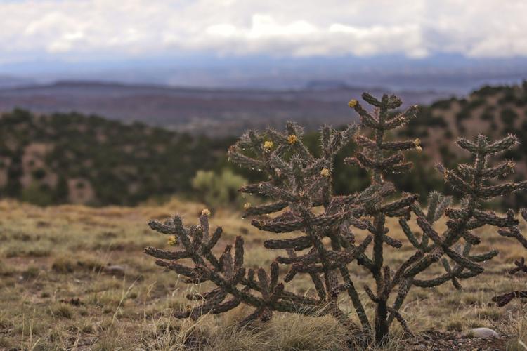
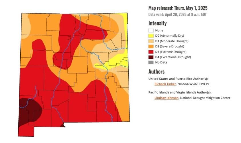
After a fairly dry and windy April, in which New Mexico creeped deeper into drought conditions, much of the state was experiencing heavy rainfall, hail, thunder and — in some cases — late-season snow. While there were some fears of the potential for flash flooding in burn scars, there were no reports of heavy floodwaters by Monday afternoon.
National Weather Service meteorologists advised New Mexicans to curb their enthusiasm about the positive effects of the rain, however. The precipitation is needed, they said, but it's not likely to make a major dent in the statewide drought or make up for a lackluster snowpack.
"I just want to temper expectations," National Weather Service hydrologist Andrew Mangham at a Monday weather briefing. "This is great rain; I'm glad we're getting it. This did not save winter for us in terms of our water supply."
There are winners and losers when it comes to precipitation.
While the eastern and northeastern parts of the state are expected to see between 1 and 3 inches of rain and snow through Wednesday, other areas — namely, the southwest — are likely to miss out.
Santa Fe is expected to see between 0.7 and 1.4 inches of rain; however, Truth or Consequences and nearby cities will likely see less than a tenth of an inch.
A flood watch was in effect from Roswell to Raton, with the National Weather Service's Albuquerque office reporting "severe" thunderstorms were expected to bring hail, lightning and intense gusts of wind to Eastern New Mexico on Monday night.
The heavy rainfall creates a risk of flash flooding, meteorologists warned; although, as of Monday afternoon, that hadn't come to fruition.
"Knock on wood, we haven't seen a ton of really devastating flash flooding impacts yet from this," Mangham said, "even though some of these rainfall amounts are, to be clear, way above normal and were delivered in a pretty torrential amount from some very severe storms marching their way across New Mexico."
Jesus Romero, the deputy county manager and acting emergency manager for San Miguel County, said there had been minimal reports of flooding as of noon Monday. County officials had been checking typical "problem areas" for flooding.
River flows are somewhat elevated, Romero said, but “nothing we’re not used to, nothing we’re not prepared for.”
He added, “It’s just runoff at this point.”
Meteorologist Daniel Porter said minor flooding was expected at Vermejo River near Dawson in Colfax County.
"So far, it sounds like we've gotten off easy and have had just a little bit of low-level flooding. ... About everything else is just soaking in and greening things up," Porter said.
High-elevation regions of the state could see a layer of snow by Tuesday morning, and photos of Bobcat Pass in Taos showed the area was already blanketed white Monday.
Santa Fe Baldy sports fresh snow on Monday, May 5, 2025.
Matt Dahlseid/The New Mexican
Mangham said there had been a slight improvement in the snowpack in the northeastern corner of the state. But other areas remained at a snowpack standstill.
"Some people are getting very excited that the mountaintops are white," Mangham said. "... That's good news. That's helpful. But we need much more of that to really change the hydrologic contribution of snowmelt to the state of New Mexico."


